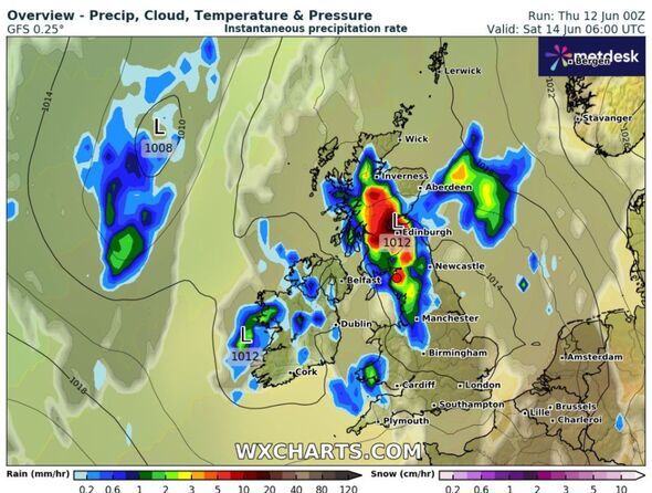
than 440 miles from the Midlands to the mountains of the Highlands is set to deliver a knockout blast of wet weather this weekend. The washout conditions are forecast to arrive on Saturday, June 14 according to new charts from weather watchers WXCharts.
The wet conditions come as a series of yellow thunderstorm weather warnings are covering parts of the country until the weekend and the Met Office is predicting the humid conditions could combine to make the hottest day of the year on Friday, with 30C predicted.
heavy rains and possible flooding could be on the cards for those living in major cities such as Birmingham, Manchester, Liverpool, Glasgow and Edinburgh. The Met Office said that some areas may see about two inches of rain in a few hours and winds of up to 50mph between Thursday and Saturday.
Yellow Heat Health Alerts have also been issued by the UK Health Security Agency (UKHSA) from 9pm on Thursday to 8am on Sunday covering the East Midlands, London and the South East and wider eastern areas.
Heat Health Alerts are issued when temperatures could affect people's health and lead to an increased use of healthcare services by vulnerable people.
A statement looking ahead to the weekend from the Met Office said: "The thunderstorms and a wider area of showers will move north and east through Thursday, leaving more settled weather for a time through Friday for most.
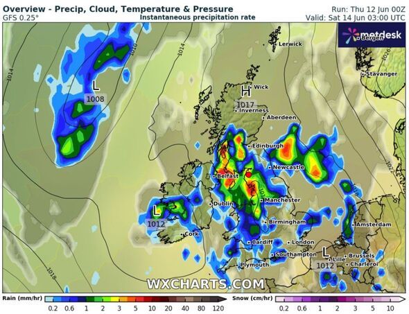
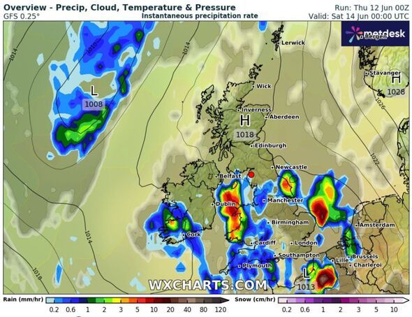
"However, another band of thunderstorms moves in again from the south-west later Friday bringing further intense rainfall into the early hours of Saturday.
"The south is forecast to become more settled with temperatures a little above average while northern parts of the UK, especially the northwest, are likely to be more changeable, with spells of stronger winds, cloud and some rain at times."
Today:
Rain across southwest England and Wales, heavy and thundery at times, will continue to move north and east throughout the day. Brighter conditions behind, although some heavy, possibly thundery, showers at times. Warm and increasingly humid, despite the breeze.
Tonight:
Rather cloudy with patchy rain at times in the west, occasionally heavy at first. Clearer spells further east. A very mild and muggy feeling night, especially in the south.
Friday:
Largely dry by day with occasional brighter spells and some showers in the west. Heavier, thundery rain arriving from the south and southeast during the evening. Remaining warm and humid.
Outlook for Saturday to Monday:
Heavy rain and thunderstorms moving north Saturday with hail and gusty winds. These easing on Sunday to leave a largely dry day with bright spells on Monday. Feeling fresher.