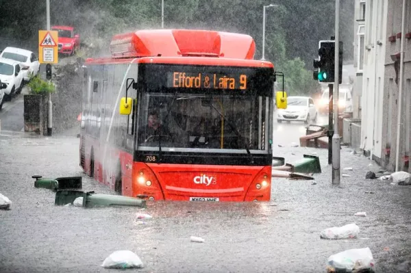
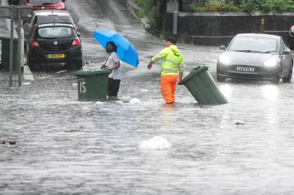
Brits have beenthat have left streets underwater as major flooding hits parts of the country. Residents were pictured struggling to stop water gushing into their homes and businesses in Plymouth, after heavy rainfall, with cars and buses left submerged in the streets.
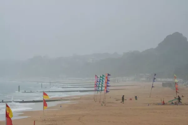
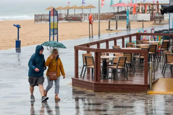
The said that some areas may see about two inches of rain in a few hours and winds of up to 50mph between Thursday and Saturday. Temperatures may reach 30C on Friday, which would make it the hottest day of 2025, surpassing the 29.3C recorded at Kew Gardens in west London on May 1.
READ MORE:
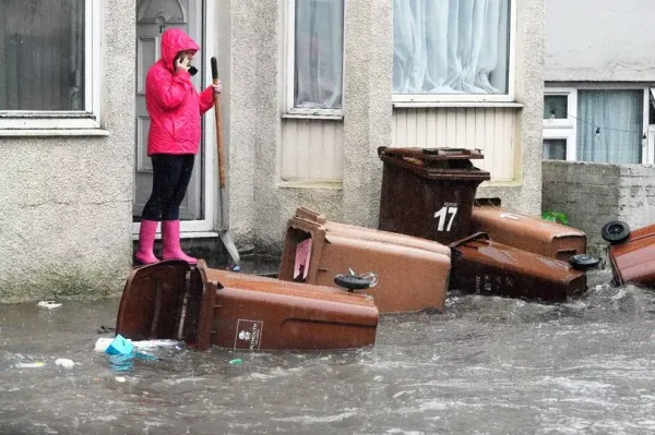
It means the parts of the UK could be hotter than Ibiza, Mykonos, and even Los Angeles. New images show drivers trying to make their way through large floods with major traffic congestion in the southwest.
A major road in the city is currently closed due to flooding. There are major traffic delays near Gdynia Way and Exeter Street as heavy rain has flooded the roads. One witness has told PlymouthLive it is "chaos". They said: "Cars getting stuck heading into the cinema way".
Plymouth Highways has confirmed Gdynia Way is currently closed in both directions. It said: "Gdynia Way is currently closed in both directions due to flooding". It also added that Kings Street is closed. "Kings Street is currently closed due to flooding near the junction with Western Approach".
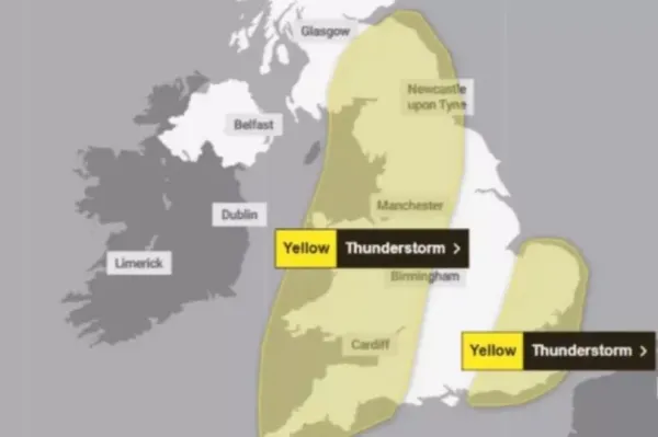
The Met Office has a yellow warning for thunderstorms across the southwest of England, the west of England and across Wales. It is in place until 7pm this evening. At the same time there is a yellow warning for rain in Northern Ireland until 9pm.
The thunderstorm warning reads: "An area of rain will continue northwards across parts of southwest England and Wales during Thursday.
"The rain will be locally heavy. A few places may see 10-20 mm of rain in an hour, and 30-40 mm in 3 hours or less, leading to a risk of disruption. There is a chance of some thunderstorms forming within this area, particularly during the afternoon. Winds will also be strong at times, perhaps gusting to 40-50 mph around hills and coasts."
The UK Health Security Agency (UKHSA) has issued its first yellow heat-health alert of the year, running from 9pm Thursday to 8am Sunday and covering the east of England, East Midlands, London, and the south east.
Forecasters say an inch and a half of rain could fall over a few hours and winds could reach 50mph. Other regions may see showers, but northern England and are expected to remain mostly dry and warm, with highs of up to 27C, the Met Office said.
From Friday afternoon, thunderstorms are forecast across eastern and south-eastern England, including London, with up to 50mm of rain possible in a few hours before conditions ease on Saturday morning. These storms could bring flooding, travel disruption, power cuts, and damage from hail, lightning and gusty winds, forecasters said.
Earlier on Friday, conditions are expected to be dry with temperatures between 27 and 28C but there may be highs of 30C if skies remain clear, the Met Office said.
Met Office forecaster Simon Partridge said: “We’ve got a very warm, humid, spell of wet to come. “It’s all because we’ve got air moving in from the south, so the air is originating across Spain and Portugal and has been moving its way northwards.
“We’re going to see increasingly humid conditions with very warm days and some quite muggy nights as well and the general gist is that western parts of the UK are likely to see the majority of the rain and the thundery showers. But, as we go into Friday, we could see some of that also moving across the east and south east as well for some thunder there for a time.”
What should I expect from storms?Spray and sudden flooding could lead to difficult driving conditions and some road closures
Where flooding or lightning strikes occur, there is a chance of delays and some cancellations to train and bus services
There is a slight chance that power cuts could occur and other services to some homes and businesses could be lost
There is a small chance that homes and businesses could be flooded quickly, with damage to some buildings from floodwater, lightning strikes, hail or strong winds