Some regions should prepare for flooding today - despite the scorching 32C heatwave, forecasters say.
A yellow weather warning for thunderstorms blankets large swathes of England as a band of low pressure will abruptly end the sunny spell. Although temperatures peaked at 32C on Thursday in west London, today's picture will be a mixed bag - and it is largely a north-south divide.
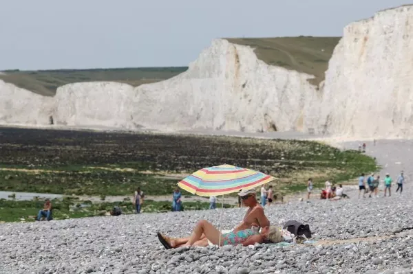
Sweltering highs of 33C are anticipated in and around London but it will be cooler - and wetter - across northern regions. With the drop in temperatures will come rain, heaviest over Merseyside, Lancashire and Cumbria. These areas, in addition to several others, are subject to the weather warning for storms which, like last Saturday's alert, is in place because of significant hazards.
"There is a small chance that homes and businesses could be flooded quickly, with damage to some buildings from floodwater, lightning strikes, hail or strong winds... There is a slight chance that power cuts could occur and other services to some homes and businesses could be lost," the Met Office website reads.
READ MORE: Iran earthquake strikes near nuclear site amid rumours of Republican Guard 'testing'
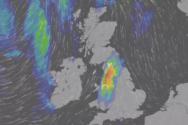
The storms will be scattered from around 3pm and linger throughout the night. Hail and gales are likely in some areas, particularly across the Lake District and Yorkshire Dales.
The weather warning continues: "Spray and sudden flooding could lead to difficult driving conditions and some road closures. There is a small chance that some communities become cut off by flooded roads.
"The most intense thunderstorms could produce frequent lightning, large hail and gusty winds, along with some heavy downpours for a time. This may lead to some surface water impacts in places."
Further rain - albeit less heavy - is expected across the same regions on Sunday afternoon. North Wales will also see showers on Sunday, marking an end in these parts to the glorious weather most of the country has experienced recently.
But Brits across southern England, and parts of the Midlands, will dodge showers for the whole weekend, forecasters say. The warmest regions will be the Southeast of England and East of England but it will also be pleasant across the Midlands and Southweast of England. Drizzle is anticipated across south Wales this afternoon.
The Mirror reported yesterday how another band of low pressure will eventually creep across the UK from the southwest and, as a result, vicious thunderstorms will batter other areas soon. Weather maps show around 30mm of rain - more than half an average June's total - will lash across parts of the Midlands, the Home Counties and the East of England on Saturday June 28. It clashes with Glastonbury - and Somerset is expected to see some wet weather that weekend.