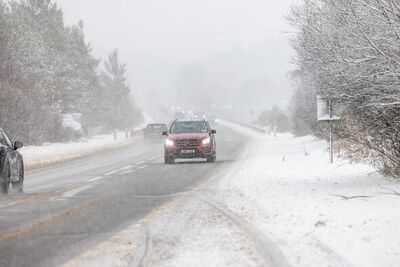
UK snow maps have revealed a giant 650-mile band of bitterly cold weather is set to hammer cities across Britain. New UK weather charts show a sweeping band of heavy snowfall stretching from Scotland to the south coast.
The key concern is that the snowfall is not confined to hills or mountains, with charts indicating it could settle across lowland towns and cities, where snow typically causes the most disruption. Fresh forecast models indicate a low-pressure system moving across the UK will drag freezing Arctic air southwards, creating widespread snowfall around March 11. The weather maps from WXCharts show a large snow shield covering much of England and parts of Scotland and Wales by that Wednesday, with snow falling through the morning and into the afternoon. The first flurries are expected overnight into the early hours, particularly across northern England and Scotland. By morning, the snow spreads south and east, intensifying through the Midlands before pushing into eastern and southern England around the commute. The system is forecast to peak late morning into the afternoon.
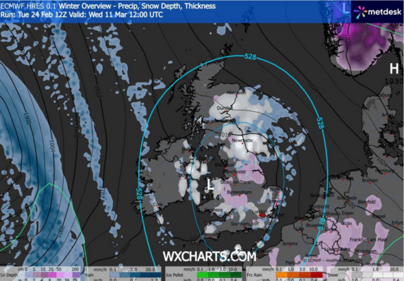
The charts show a classic battleground setup, with milder Atlantic moisture colliding with entrenched cold air over the UK.
That combination typically produces Britain's most disruptive snow events - prolonged, steady snowfall rather than brief wintry showers. Because winds are relatively light, snow can fall over the same areas for hours, allowing accumulations to steadily build.
Forecast models indicate several centimetres could settle in places, with local totals of around 5-10cm possible under heavier bands.
Once the low pressure moves away to the east, clearer skies are expected overnight. This actually increases the danger, as fresh snow cover followed by clearing conditions can trigger a widespread hard frost.
Icy roads and pavements are therefore likely into the following morning, and even modest snow depths can cause significant disruption as untreated surfaces quickly freeze when temperatures drop below zero.
Motorists and commuters are being urged to monitor forecasts closely, as conditions could deteriorate rapidly once snowfall begins.
*** Ensure our latest news headlines always appear at the top of your Google Search by making us a Preferred Source. Click here to activate or add us as Preferred Source in your Google search settings. ***
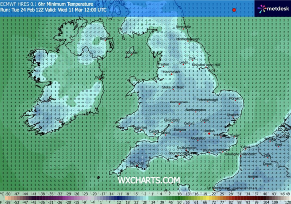
The maps show temperatures could plunger to as low as 0C to -3C across central England, with colder pockets near -5C.
Because the air mass is already cold, the precipitation falls as snow rather than rain - meaning it is far more likely to settle, even at low levels.
Crucially, this isn't confined to the hills - the charts indicate snow settling at low levels, the type most likely to trigger travel disruption.
Overnight clear spells behind the system are also expected to bring a sharp frost, with icy stretches likely into the following morning.
With winds relatively light, snow may linger on the ground for several hours rather than quickly melting, increasing the risk of hazardous roads and pavements.
Meteorological charts also show a deep pool of cold air covering the UK, meaning temperatures may struggle to rise above freezing even after the snow clears.
Cities within the snow band include:
Scotland
Aberdeen
Dundee
Glasgow
North East & Yorkshire
Newcastle
Middlesbrough
York
Leeds
Sheffield
Hull
North West
Manchester
Liverpool
Preston
Midlands
Birmingham
Stoke-on-Trent
Nottingham
Leicester
East & South East England
Norwich
Peterborough
Cambridge
London
Luton
South & Wales
Bristol
Cardiff