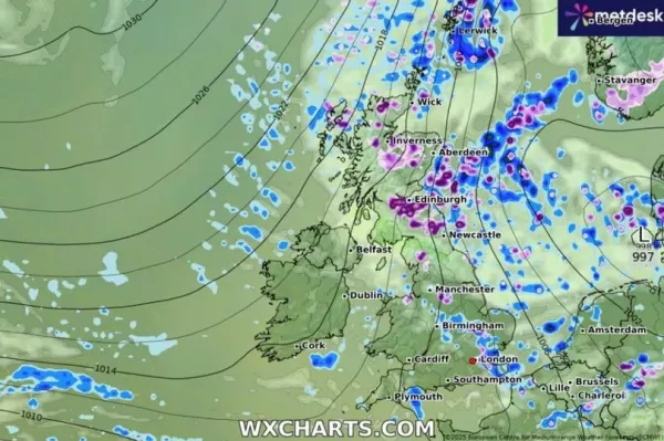
April is known for its showers - but it looks like the UK will also have to put up with a battering of , according to data from one model. Parts of , and are set to experience serious snow - with some areas seeing seven inches before the end of the first week of next month.
The snow is expected to come in from the east over Europe, having a serious impact by 6pm on April 6. It will end up covering some 51 counties across the British isles, while the only country that looks set to avoid the Arctic blast entirely is .

This 'Beast from the East' will start to pepper the east of the UK by early evening on April 6, according to WXCharts' maps. Regions affected include Essex in the south-east of England as well as areas around and .
READ MORE:
READ MORE:
Much of the Midlands and the north of England miss out on the white stuff initially, but it picks up again in Northumberland, close to the Scottish border. Up in proper, the snow storm appears to run through Edinburgh, Aberdeenshire and parts of the Highlands up to Wick.

The Outer Hebrides will have a touch of snow, too. Only a small area in north Wales will have any flakes in that part of the UK.
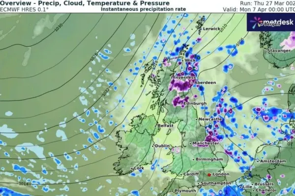
Into the early hours of April 7, the snow looks to have dispersed from much of England and is only heavily concentrated across Manchester and the eastern parts of Yorkshire on the maps. In Scotland, much of the snow focus is in and around Edinburgh and the Highlands at this time.

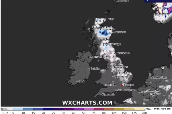
By 6am on that same day, more snow is due to make its way across the UK. It appears to stretch from Essex all the way up the coast through Lincolnshire and again up to Northumberland.
The majority of Scotland will see some snow around that time too, with a peak snow depth of 18cm (seven inches) in the Highlands. In England a depth of 4cm (1.5 inches) is forecast for the northern part of Norfolk.

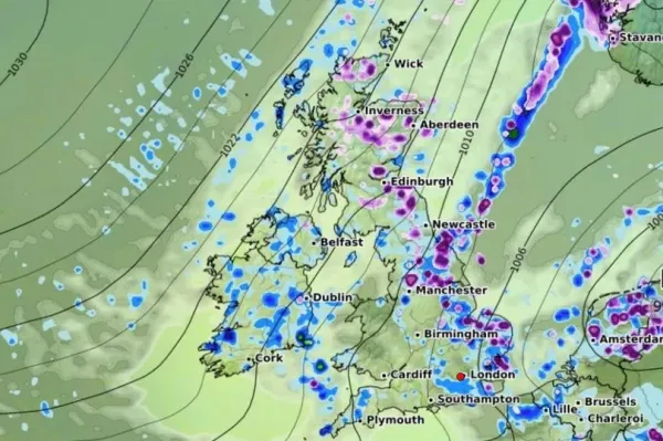
By 12pm on that day, long stretches of the UK's western parts are predicted to still have some snow falling. Although it will have eased off in Scotland, chunks of North Yorkshire and East Anglia as well as Manchester and Essex are expected to see snow falling at a rate of around 2cm per hour.
Weather has warned of Arctic cold snaps moving across to the UK from Scandinavia at the start of next month. The BBC forecast for March 31 to April 6 states: "As April arrives, global weather prediction models are still experiencing some difficulties in depicting a consistent weather pattern. Some are showing a stronger high pressure signal shifting over the far north-west of Europe during next week. This could lead to an increased risk of a colder snap, with air masses of Arctic origin possibly moving across the United Kingdom from the north or north-east from Scandinavia for example.
"Other weather model solutions are going for a stable high pressure dominated pattern, with the high pressure becoming settled over parts of the UK for a while and later shifting towards Scandinavia, ensuring a lot of dry weather with lighter winds.
"However, the high pressure could eventually move towards Iceland and Greenland towards the end of next week, opening the door for a colder north-west to northerly flow as mentioned above. Then, even slight overnight frosts are possible, among with some wintry showers on the higher ground."


