A ferocious 247-mile "wall of snow" is poised to batter the UK within days, with striking new weather maps showing 19 major cities preparing for wintry disruption.
The latest weather charts reveal a massive band of snow sweeping in from the Atlantic and racing across the nation within hours, bringing heavy snowfall from Northern Ireland through Wales and into England and Scotland.
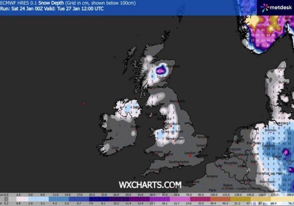
Maps from WXCHARTS display extensive white areas, signifying snowfall, advancing into the UK on Tuesday, January 27, as a deep low-pressure system moves in from the southwest. By midday, north Wales, the whole of Northern Ireland, and substantial parts of Scotland are predicted to be blanketed in snow, with certain areas experiencing up to a remarkable 55cm.
Across England, snow is forecast to strike Cumbria, Manchester, Birmingham, Liverpool, Blackpool and significant portions of Yorkshire as the icy front pushes eastward. Weather experts say the snow wall will span more than 200 miles from north to south, essentially dividing the UK in half as it sweeps across the country.
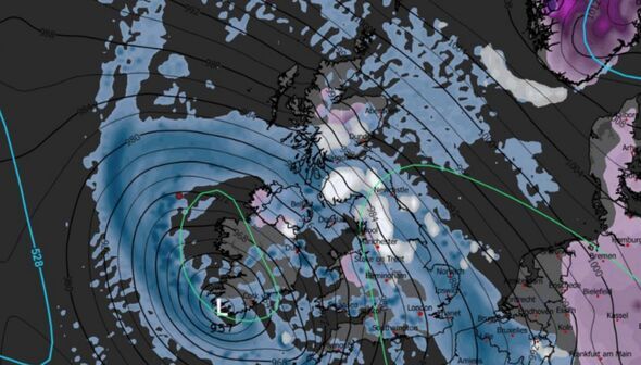
By 3pm, conditions are anticipated to worsen significantly for many areas, with rain spreading into additional regions and making already grim conditions even more unpleasant. WXCHARTS maps indicate most parts of the UK will be drenched by heavy rain later in the day, with only a few regions managing to escape the worst of the deluge.nd parts of south Wales are among the fortunate few expected to remain predominantly dry. The Met Office's five-day forecast presents a grim outlook as an icy onslaught approaches, according to the Express.
It states: "Remaining unsettled throughout, with bands of rain moving north and east across the country, particularly on Tuesday when another deep area of low pressure approaches from the southwest. Feeling cold."
Sunday offers scant respite, with the weather agency forecasting a cloudy day for the UK, punctuated by numerous bouts of rain or showers. The Met Office's weather warning elaborated: "There will be a few brighter breaks developing, with many areas becoming dry later. There is further hill snow likely across parts of northeast Scotland."
This impending 'snow wall' follows closely on the heels of heavy rainfall that has recently drenched vast portions of the UK, leading the Met Office to issue weather warnings across 32 regions this morning.
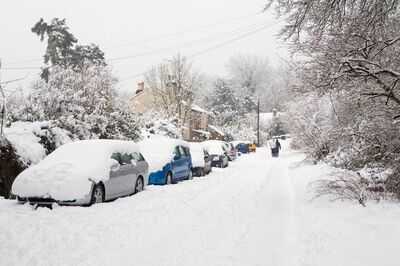
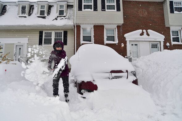
The nation braces itself for potential flooding, travel disruptions and power outages as it transitions abruptly from torrential rain into heavy snowfall and freezing conditions. Motorists and commuters in major cities such as Manchester, Birmingham, Liverpool and Belfast have been advised to anticipate challenging travel conditions as the blizzards set in.
Meteorologists warn the pace and scale of the approaching snow band may take residents by surprise, with weather conditions worsening sharply within a matter of hours. As sub-zero temperatures are forecast to sweep in behind the system, any accumulated snow is expected to remain, increasing the danger of treacherous roads and footpaths throughout the middle of the week.
 Full list of cities set to see snow
 England.
Manchester.
Liverpool.
Carlisle.
Birmingham.
Stoke-on-Trent.
Salford.
Chester.
Lancaster.
Scotland.
Dundee.
Perth.
Stirling.
Wales.
Bangor.
St Asaph.
Northern Ireland.
Belfast.
Derry.
Lisburn.
Newry.
Armagh.
Bangor.